(Working with “ghostly traces”—infrastructure that has been physically removed but remains visible to those who look closely. Walking artists like Ellen Mueller in Walking as Artistic Practice, and Stuart McAdam’s Lines Lost describe this walking as ‘a tool to reawaken these forgotten histories in the public mind’ and where the journey serves as the primary method for gathering this information. Rather than just viewing the landscape, I want to use walking to “interrogate” the social and industrial shifts of the last 50 years, specifically the impact on our small village.)
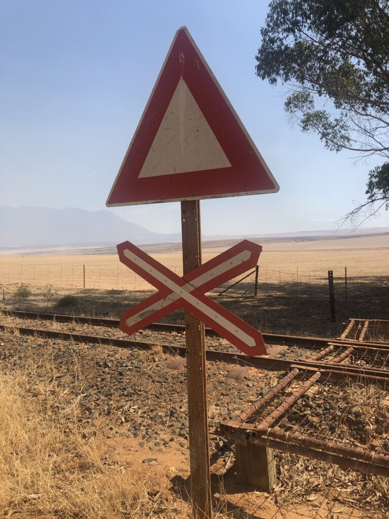
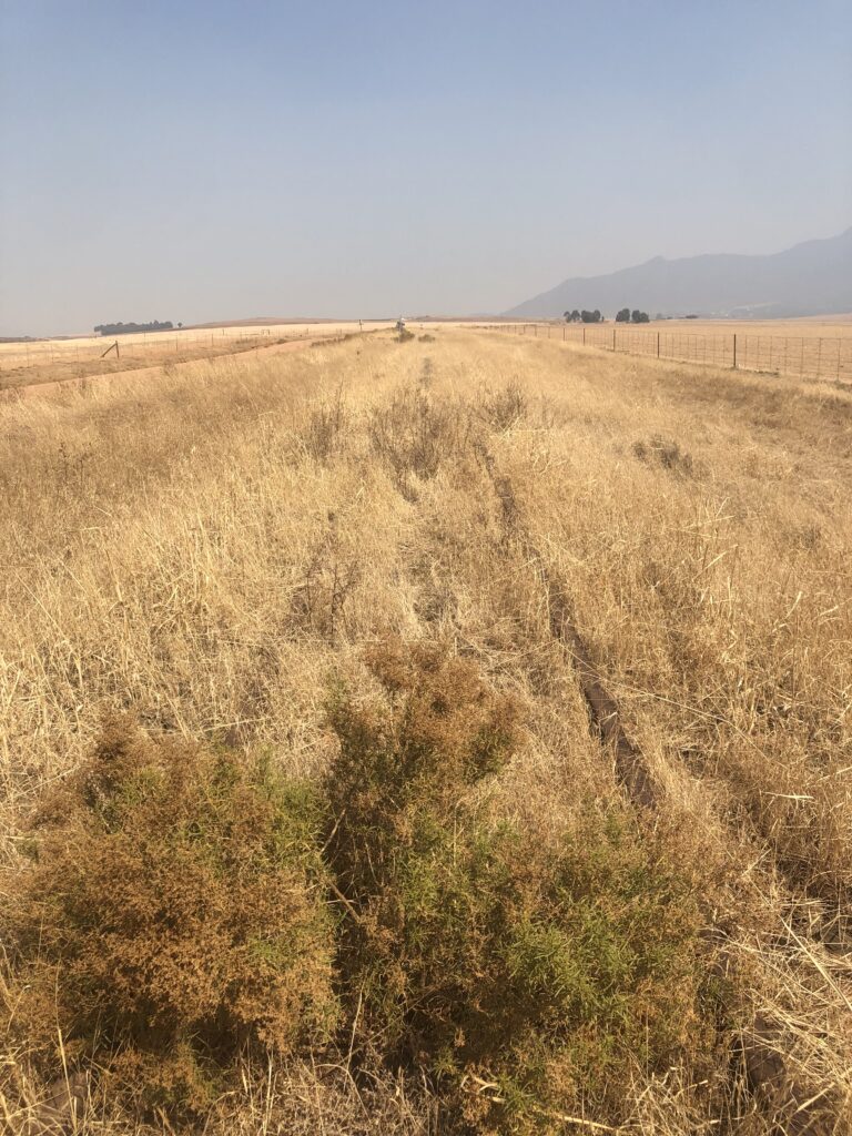
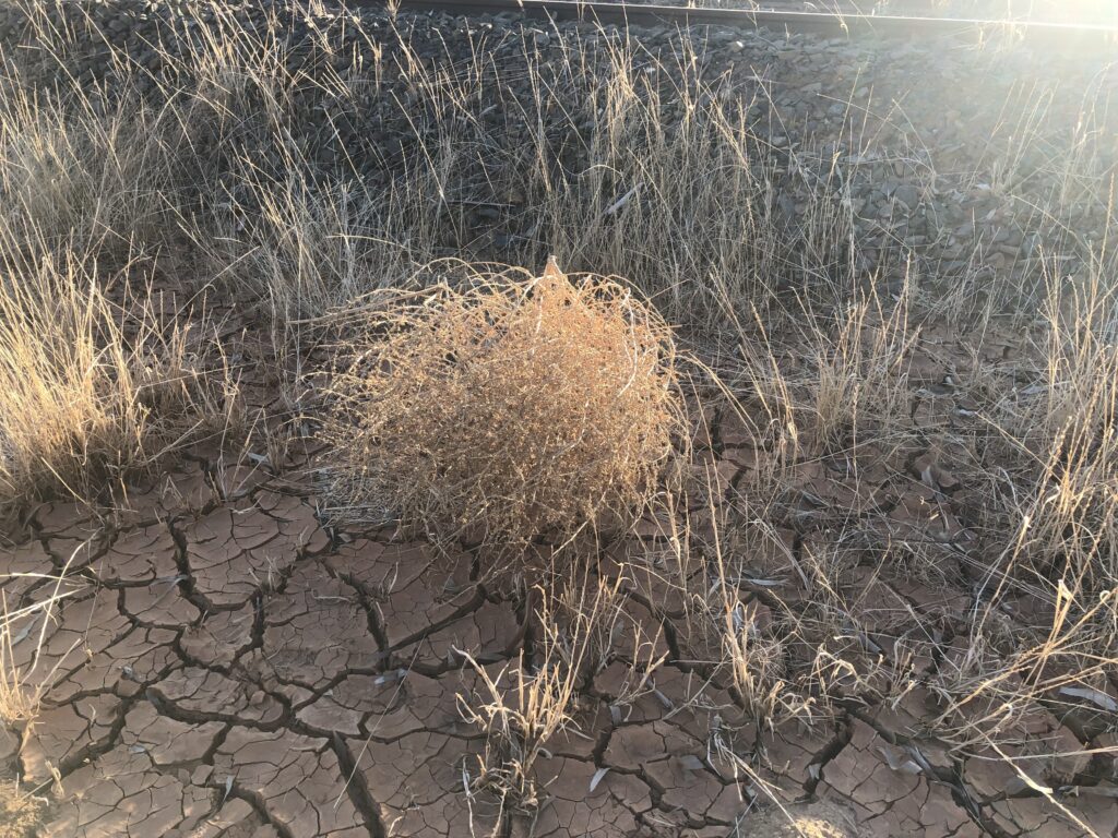
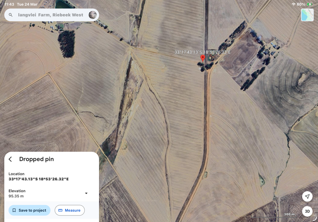
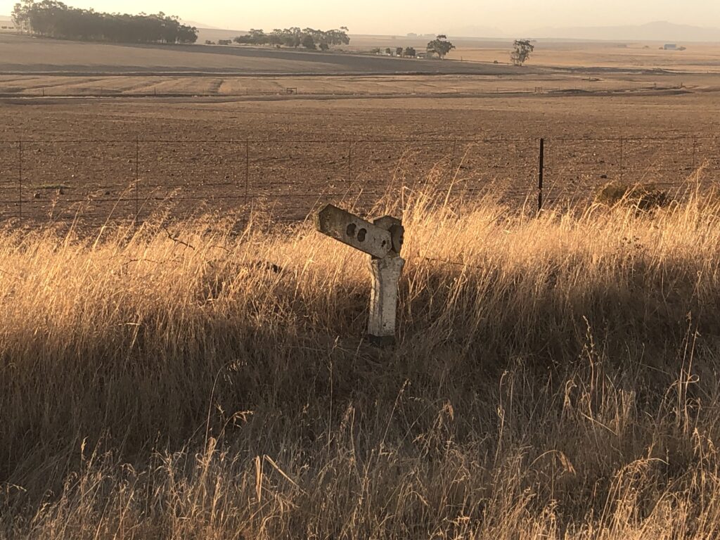
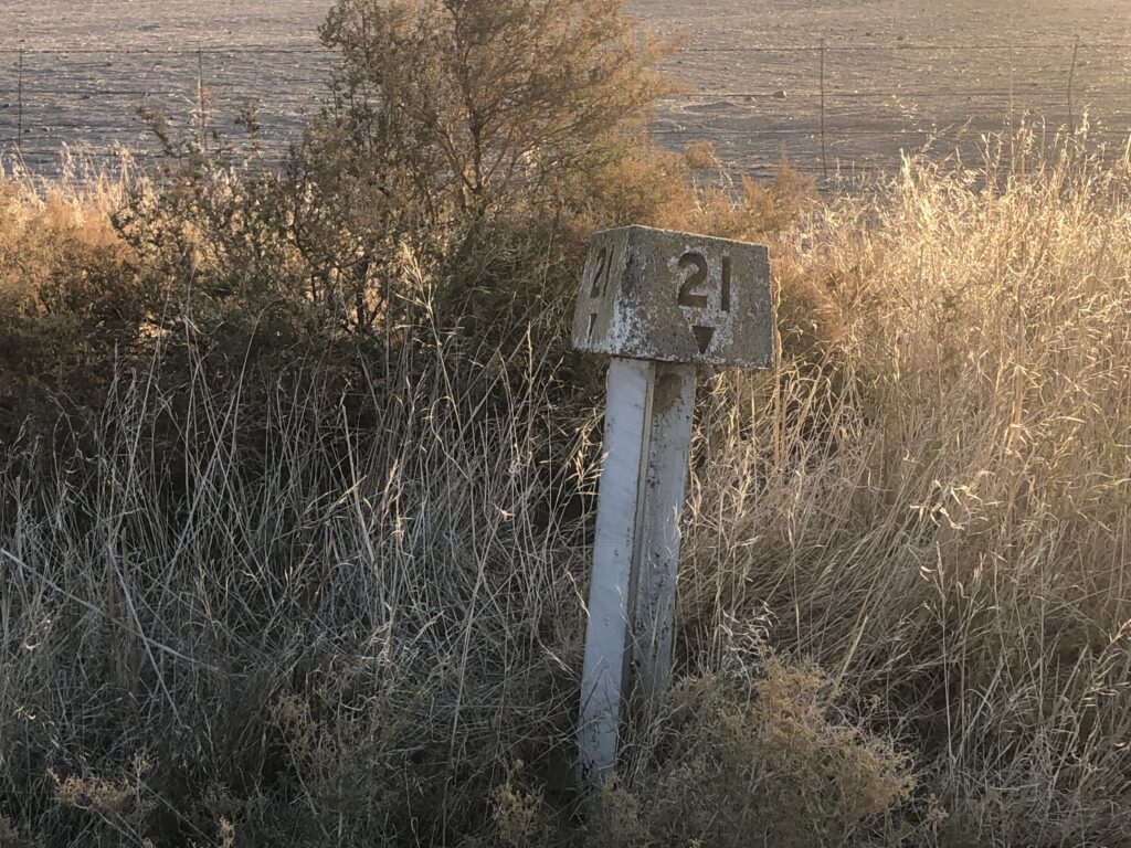
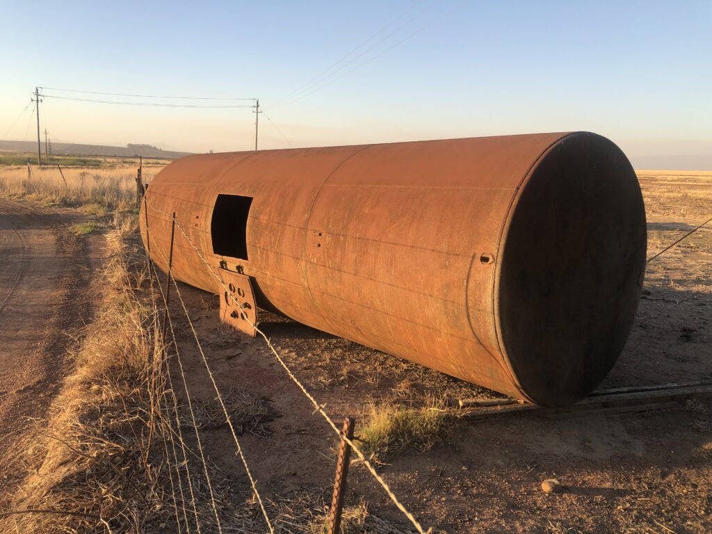
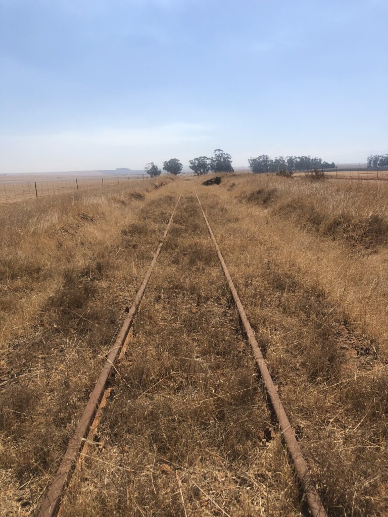
A decommissioned railway line runs parallel to a connecting dirt road, when I leave my home. This road is known locally as Station Road or Gouda Road. It is a route being driven and walked regularly, yet the iron tracks and the skeletal remains of a derelict station appear only in fragments. Over time, the mechanical thunder of the train has been replaced by a heavy silence, and weeds and indigenous plants have reclaimed the space between the sleepers. The line has transitioned from a corridor of transit to a communal path, now occupied by the quiet rhythms of pedestrian, runners and wildlife. To me, it is a site of ‘stopped’ time, waiting to be witnessed at a human pace.
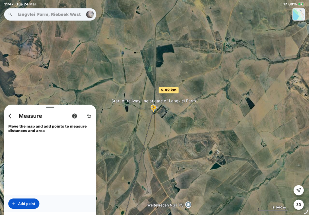
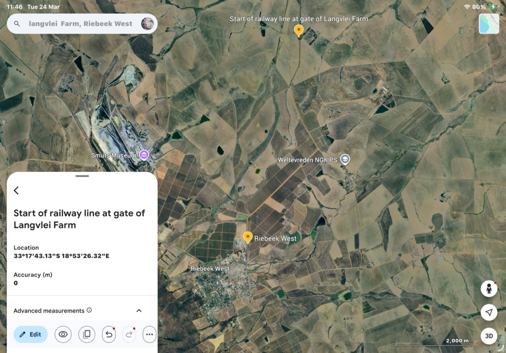
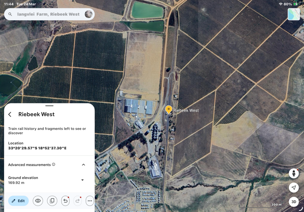
For this project, I will follow the lost railway line from the farm where I live to the town of Riebeek West where a station used to be. My artistic method will be in the form of walking as an artistic practice. I will document this slow pilgrimage by working with photography, sound recordings, drawings, plants, trees, animals, birds and found objects. I look forward to the stories to be told and shared of those who walked and still walk this land.
INTRODUCTION
Each journey to town begins at the farm gate, a departure from the private stasis of home into the public landscape. To reach Station Road, I must first cross the physical spine of the railroad—a momentary vibration beneath the car tyres that signals a transition. While I drive this route at a modern velocity, my walking practice seeks to deconstruct this crossing. Although I cannot replicate the industrial rhythm of the trains that once occupied this line, the act of walking allows me to enter what Aldred describes as an ‘enduring mobility of the past.’ Stepping onto the tracks is an entry into a different frequency of time, one where the steel acts as a dormant conductor, and my body becomes the needle tracing the record of what remains.
Below is a map showing the branch line as shared with me by the son of a train driver who worked on this line during 1970 and 1974 (Rufus Vermeulen, 25/03/2026). From this, I not only learned about the map and where the rail runs, but also that it was opened on 3 April 1949.
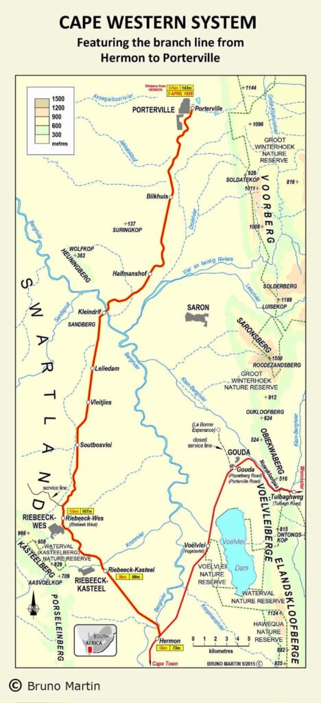
Stories from archives I could access are about the heydays of freight train transport and show that this line allowed the transportation of agricultural produce, schoolchildren, and labourers, serving mostly the surrounding farms. In the early 20th century, our town, Riebeek West, had a prominent railway station, serving mainly the farming community. This branch line from Hermon into the Riebeek Valley was a late addition to the Cape rail network, primarily driven by the Swartland area’s wheat boom. To give this more context, I share the following I read: “By definition, a branch line is a secondary line which branches off a trunk line, that enables rail traffic (either passenger or produce) to be carried onward from the country districts to the major centres (ports or markets).” (https://www.theheritageportal.co.za/article/streaks-rust-across-veld-demise-branch-lines#:~:text=The%20reign%20of%20the%20branch%20line%20railway,become%20streaks%20of%20rust%20across%20the%20veld.)
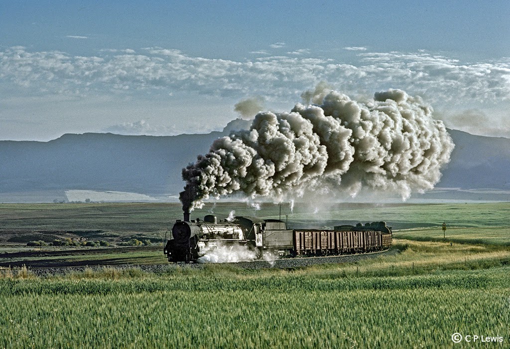
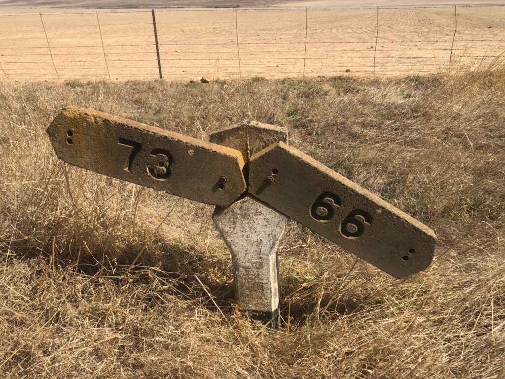
So I think it is fine to presume that this line, specifically around Station Road and on local farms (where I also reside), was aimed at connecting the wheat and wine-producing Swartland region to the main rail network. The daily mixed to Porterville crossing the Berg River immediately after leaving Hermon in July 1975. In its 36 miles, the line crosses the river twice.
This part of the railroad was opened around 1929, which is almost 100 years ago. My question became, when and why did this form of transport stop? (https://sites.google.com/site/soulorailway/soul-of-a-railway/system-1-cape-western/part-15-calvinia-sakrivier-porterville-and-saldanha-branches )
An interesting opinion (context of the political situation in the 70’s) I found in my research is about how the leadership viewed the value of the railway: “The retirement of President Jim Fouche in 1975 marked the end of Presidential travel by train as his successor, the disastrous President Diederichs, was not interested in visiting his ‘subjects’ by train. A seemingly insignificant step to city-dwellers at the time, but it had the knock-on effect of devaluing life in the country towns and, with hindsight, it marked the beginning of the diminishing importance of our railway system to all South Africans. “ (https://sites.google.com/site/soulorailway/soul-of-a-railway/introduction/part-1-introduction-by-charlie-lewis.) In another article, the following was mentioned: “Although not immediately apparent, the Road Transportation Act, Act 14 of 1977, eventually caused all such lines in South Africa to wither and die. Within 15 years, the railway became redundant as lorries took all the business.” (https://sites.google.com/site/soulorailway/soul-of-a-railway/system-1-cape-western/part-14-franschhoek-and-ceres-branches)
My research into railroads in South Africa in general indicates that there is an official intention (debatable) to reverse the trend of transport towards road transport, rather than rail. (https://www.aria.org.za/wp-content/uploads/2025/03/Transport-in-South-Africa.pdf). It seems from the late 1980’s that road transport became a competitor to railroads increasingly. By this time, the rail market share seems to have declined due to operational policy constraints on the rail service provider, a direct result of the transport policy decisions of the government as the major shareholder.
ABOUT THIS PROJECT
I would say that although I would not be able to travel at the same rhythm as the train followed on this old route, the walking would, as Aldred ( ) wrote, “put me into an enduring mobility of the past”. I felt as if when walking along or on the rail, I would connect with a different time and through
different connections than the ones that went there before me.
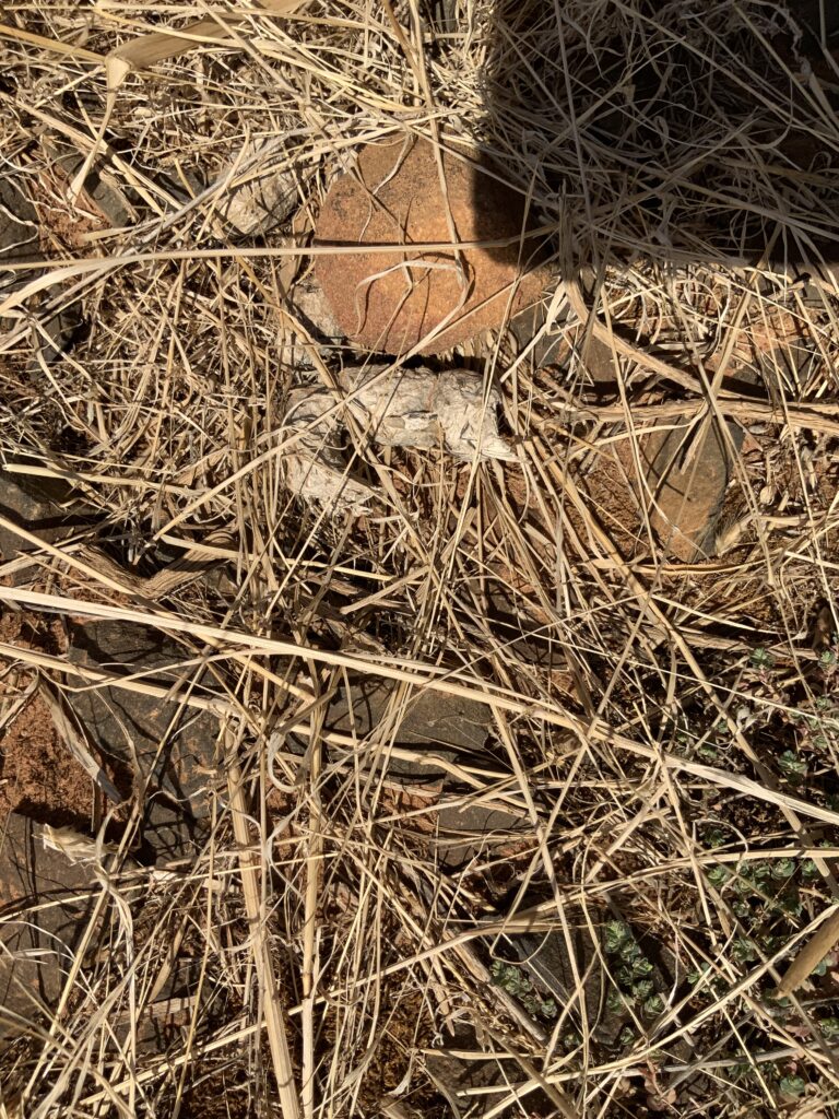
Material I work with is to be found on the site, and I use it as mark-making tools and or as forensic evidence. There is also a response to the current social ownership of the land, as well as a physical response to the challenges along the rail or terrain. I also want to look at using drawing paper to record the traces left by the walk. As a thinking structure, through Ursula Le Guin’s lens, the work is not about a painting or a work on a wall, but a vessel or ‘bag’ for holding disparate things together (time, the things I gather along the walk, the history of the rail, the stories of people….) In this also lies my own inquisitive spirit and messy process of making and gathering. Surely this making is not just walking a straight line to the station building in Riebeek West.
THE SCOUTING OF THE TERRAIN
I would think that these abandoned tracks could host “novel vegetation”—species that don’t grow in the nearby fields but thrive in the alkaline, well-drained soil of the railway bed. These plants are “mapping” a new habitat that humans accidentally created. Could it be that I would make contact with the real ‘renosterveld’ in these areas?
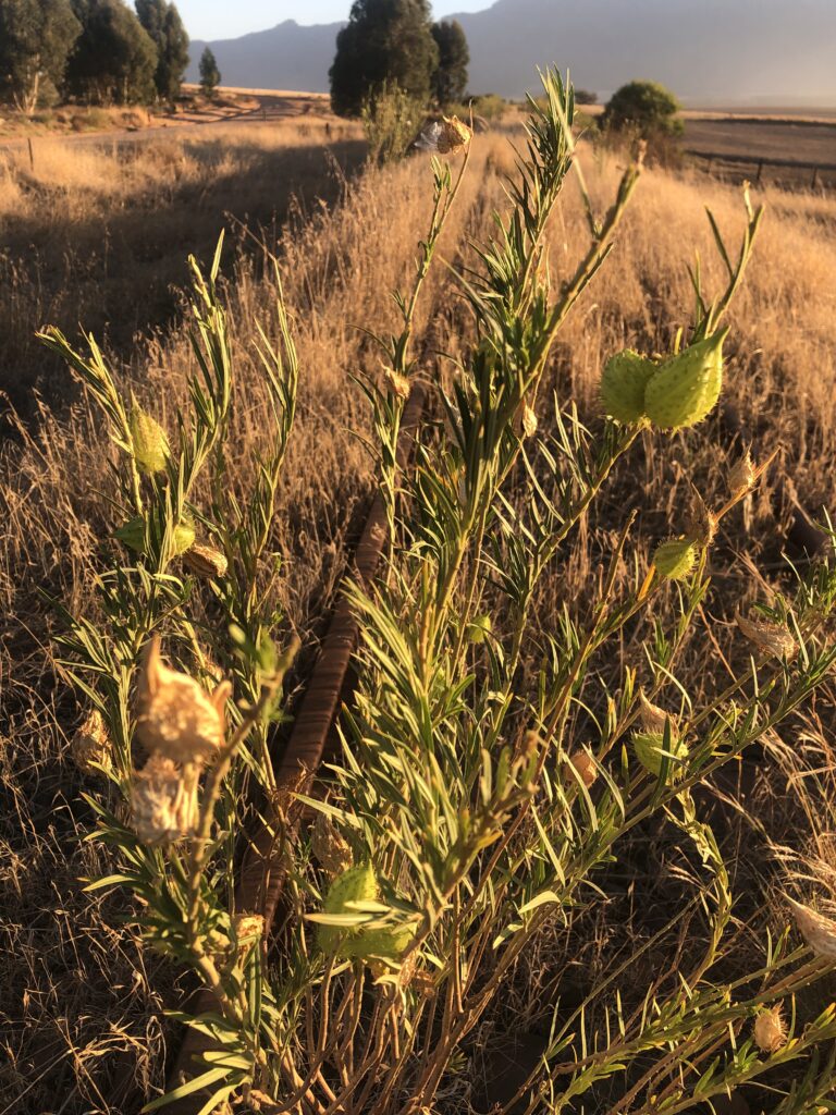
This could also be a place where the wildlife has claimed it as a type of highway? We regularly encounter bateared foxes, steenbuck, tortoises and snakes along the nearby dirt road. Can I say that the railway is a biological corridor? They use the straight line for easy travel between fragmented fields, and their left behind “signatures” (scat, prints, flattened grass) are a new map overlaid on the old one.
The “Art of Noticing” comes to mind: As a walker, I can practice “deciphering traces”—treating a bird’s nest in a signal box or a vine strangling a telegraph pole as a semiotic sign of nature “reclaiming” its territory. I want to document the walk, the train rail, and even nuance it a bit more – share a story about a history of lines that disrupted the landscape for development of land, agriculture and infrastructure deemed necessary on economic and social decisions. It will be a type of pedestrian walk along this line of iron rails, not made for walking, but also telling a story of a time when things moved at a slower pace. I might also find that it is overgrown with plants, or/or covered with soil. I hope to move from the human “map” (often about control and abstraction) to the “narrative” of a landscape. (ike moving from reading a table of contents to reading the actual novel)
Photos will be an important part of this documentation, as well as my made imprints, where I will try to capture textures on and alongside the rail line I will walk. These could have a second life as photographs and or prints, which could be installed at a viewing space/gallery and sold. I also consider having people participate in the walk – I imagine meeting up with people on the walk and talking about the line, and hearing stories about it. I think documentation could be useful as a historical archive.
I could also do the walk as a durational work – it is about 6km, which could be done over a few hours during one day – leaving time for drawings/imprints/rubbing, or over time, in which case I could use time to discover more. As a work, the work could be made public or be done alone without any publicity.

Research into the land before the trainline
Before the introduction of farming, the land was not ‘untamed wilderness’: The San hunter-gatherers and Khoikhoi pastoralists practised a form of land stewardship that left an imprint. To encourage the growth of bulbs (geophytes) as well as to attract game with fresh green shoots, regular controlled burning, by using fire as a tool, existed. Water from the local river, today called the Berg River, was also part of this seasonal movement in the area.
I tried to find historical names for this area, as it is important to acknowledge that Khoi-San names of places are amongst the oldest in the country. Archaeological findings indicate that modern humans have inhabited Southern Africa for at least 170,000 years, with the Khoi-San’s history spanning as far back as the Later Stone Age, from about 40,000 years ago. The Khoikhoi did not always have a collective name for large regions like we know today as the “Swartland,” but instead identified with specific clan territories. For example, the Cochoqua (or Goringhaiqua) were known to graze their large herds of cattle in the fertile valleys between the mountains of present-day Malmesbury and the Atlantic coast.
The name we use today, Swartland (Het Zwarte Land, translated to The Black Land), was first recorded in 1701, and was a descriptive name given by early Dutch explorers, like Jan Wintervogel and Pieter Cruijthoff, because the indigenous renosterbos vegetation appeared black from a distance after the winter rains. The first European record of the river under its current name was in 1657, when a bailiff, called Abraham Gabbema (sent by Jan van Riebeeck) named it the “Groot Berg Rivier“ (Great Mountain River).I t becomes clear that the transition to agriculture fundamentally “rewrote” the soil of this area. I also think this is where the ‘traces’ I want to follow become most visible, such as using the rail line, which was at its operational peak between the 1930s and 1970s. I would like to understand more about the decline and decommissioning of this service. One of the industries around this farming community is a Cement factory, which is still using a train, but not for the transport of its final product. It seems the line is now effectively a ‘ghost line’.
“I would rather meet the Hottentot at the hustings, voting for his representative, than in the wilds with his gun upon his shoulder”.
One could hardly be blamed for thinking that this sounds like Van Zyl Slabbert in the 1980s, Helen Suzman in the 1960s or JH Hofmeyr in the 1940s. In fact, it was William Porter, Attorney General at the Cape from 1839 until 1865, who quoted upon being tasked with drafting the completely non-racial constitution of the Cape’s first parliament in 1853. This tiny Cape village was named for the worthy gent who went on to become an influential member of the first Cape Parliament, a fact that is included for those who might be curious as to how the town got its name, as well as anyone who imagines that liberal values are only a recent phenomenon in South Africa.
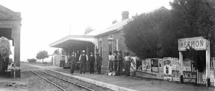
Porterville is conveniently situated in a rich agricultural/viticultural part of the Western Cape. Its connection with the Cape Main Line at Hermon was opened in 1929, one of a large number of “Agricultural railways” opened in the late 1920s, authorised by the Government as guaranteed developmental lines. In later years, the cement works at Riebeeck-Wes provided the line’s base traffic.
In common with all similar SAR lines, traffic declined drastically in the 1990s when agricultural produce went over to road haulage, except for a trickle of grains. Even the cement company abandoned rail. Recently, however, there have been signs of renewed activity, as some of the following photos by Peter Rogers imply. By now, it is clear that public transport in the area is sufficient, although the main railway line from Johannesburg to Cape Town runs through Wellington and Hermon, and there are coach services from Cape Town to the north via Malmesbury; this village lacks good public transport.
Preparations for the walk
- Gathering the stories from people who live in the village or have information about the train.
On 24 March 2026, I joined a Facebook group called Footplate Memories and posted a request for people to share their stories and photos with me. I received an excellent response: stories and photos of people who worked on or knew people who operated the train. I also learned that a ‘tourist train’ passed the village on these lines on 20 June 2002. The image below was taken of a 19D 3334 Steam locomotive on that ‘tour’. It was stated during that trip that the tracks were still navigable but required “gardening” to clear overgrowth. After a little research, I learned that the name footplate refers to the metal platform inside the cab of a steam locomotive where the driver and fireman stand to operate the engine.
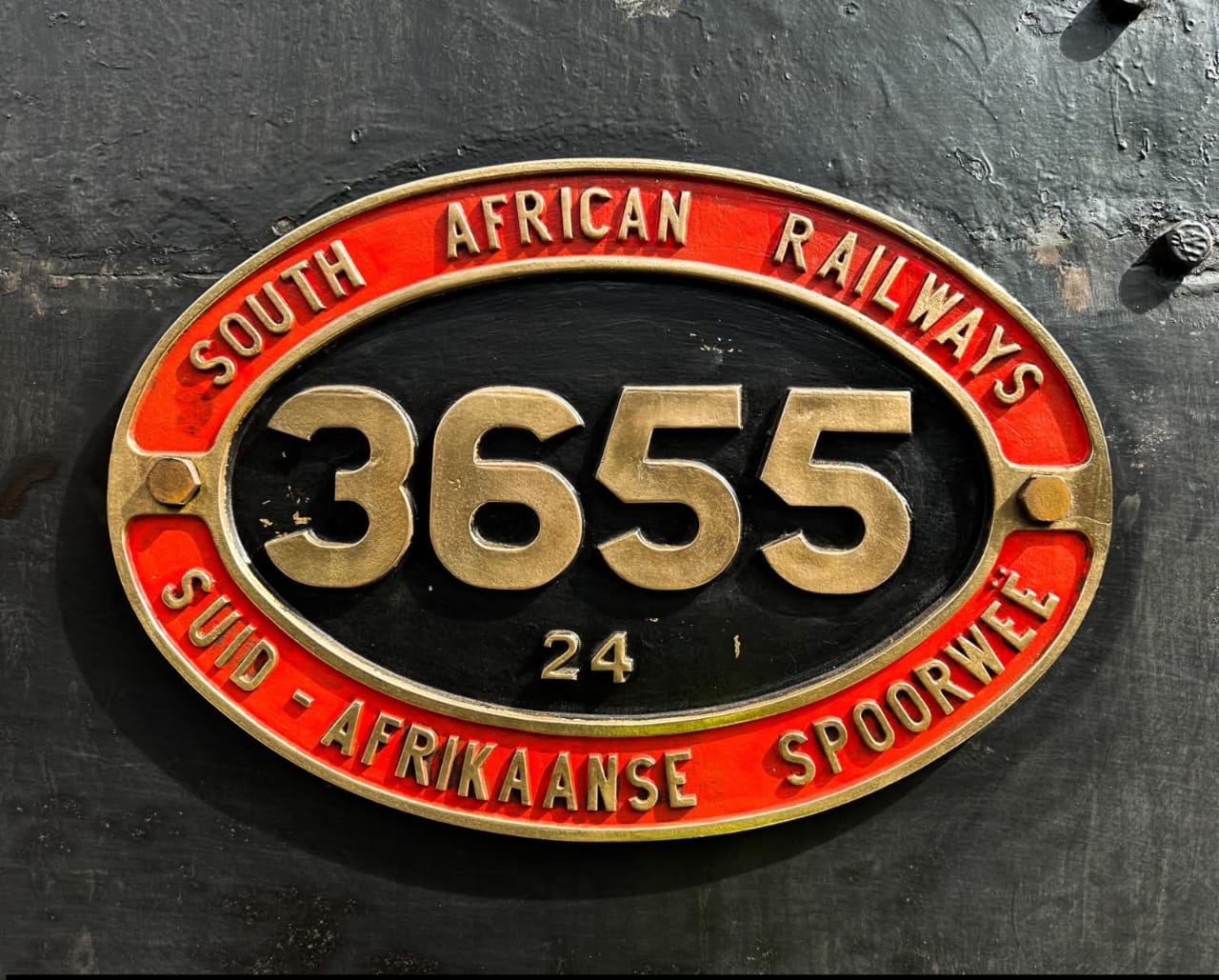
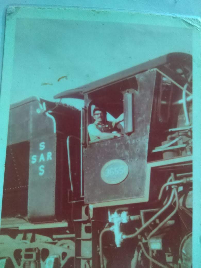
I was contacted by the son of a steam train driver, Johnny(Perd)Vermeulen, on this route in the early 1970’s – his dad drove the train in the image, but has since passed. This family lived in Hermon for at least 4 years or so, and he shared a few images with me. His dad drove a Class 24 locomotive no. 3655, called Sandra. This same train is now called Jenny and was restored to run on a private line in the seaside town of Hartenbos, Western Cape. Interesting to learn that the train has since been beautifully restored. By 1976, steam was being “retired” across the country. Johnny and “Sandra” were among the last breed of drivers of steam engines to work the Swartland wheat fields. From the posts on FB, I learned that the service was stopped in the early 1990’s. I later learned from a fireman who worked with Perd Vermeulen, Gawie, that the line was finally closed in 1992, by then diesel engines were doing the runs.
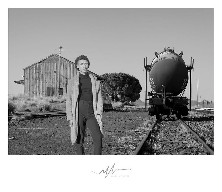
A local photographer friend took the image below in 2024 (Photo Maarten Venter)
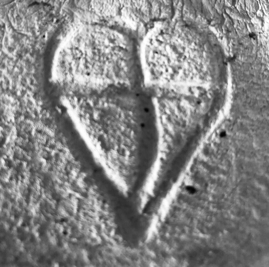
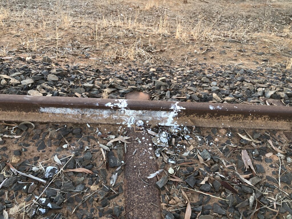
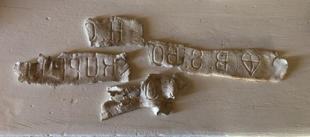
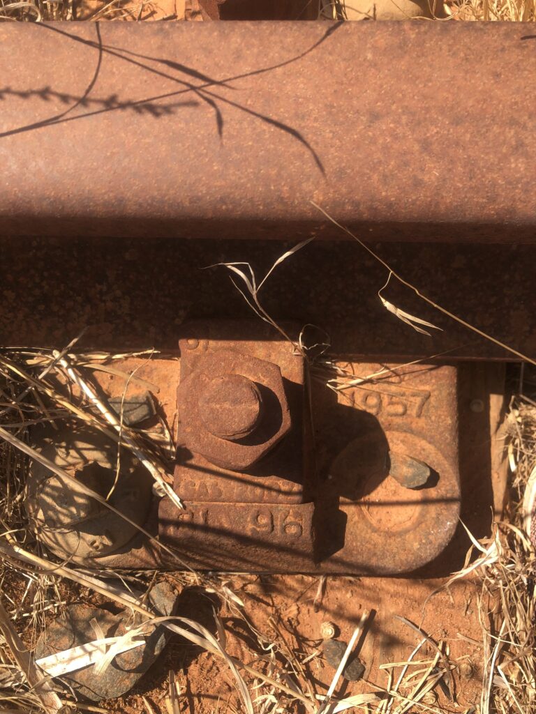
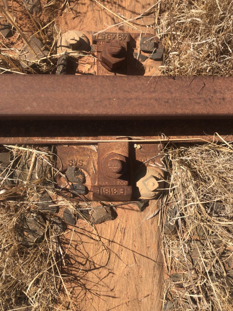
I would like to have interviews with locals about their memories of the train running alongside the village and farms. This could give me two distinct “rhythms” of the railway to document: the Commercial Pulse (the farmer’s milk/wheat, etc) and the Social Pulse(the workers’ family visits, transport to town).I made contact with a local farmer who is keen to share some stories. (plan is to meet with him after the Easter Long weekend) During a visit to the rail, close to our gate, I found embossed/stamped words on the inside of the rail that tell the history of where these rails were made, as well as the date they were laid, when the line was first opened in 1929. I learned that Krupp was a famous German industrial giant that, during the early 20th century, became a major global supplier of high-quality cast steel for railway components, including rails, axles, and springs. It seems that 135 engines of Class 19D were built by Krupp (Friedrich Krupp Maschinenfabriken, Essen, Germany) before World War II. Immediately after the war, a further 50 Class 19D’s were supplied by Robert Stephenson and Hawthorn Ltd. These versatile locomotives (nicknamed ‘Dollys’) saw extensive service on every system of the SAR and were amongst the last steam locomotives to be withdrawn from active service. Those Krupp rails were incredibly over-engineered; they had to be to support the weight of a Class 24 locomotive (about 70 tons) plus a full load of Swartland grain or PPC cement. Beyond just the lines, Krupp was famous for inventing the seamless railway tyre (the three interlocking rings in their logo represent this invention). They also built many of the steam locomotives used by the SAR, such as the Class 19D
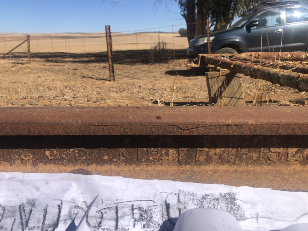
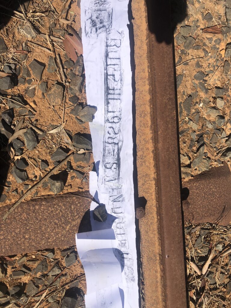
The fact that I have rubbing, and moulds of the 1928 rail, the photo of Johnny (Perd) Vermeulen in the cab, and the 3655 nameplate creates an almost complete “historical set” of the stream train service. Viewing these coordinates (33.29571°S, 18.89088°E), I realise that I am standing on a piece of “Agricultural Railway” history. In 1928, this area would have been a hive of activity with construction crews laying these exact German-made rails to connect the valley to the Cape Main Line.
For me, this is a form of mapping: as an unintentional autobiography left on the landscape.
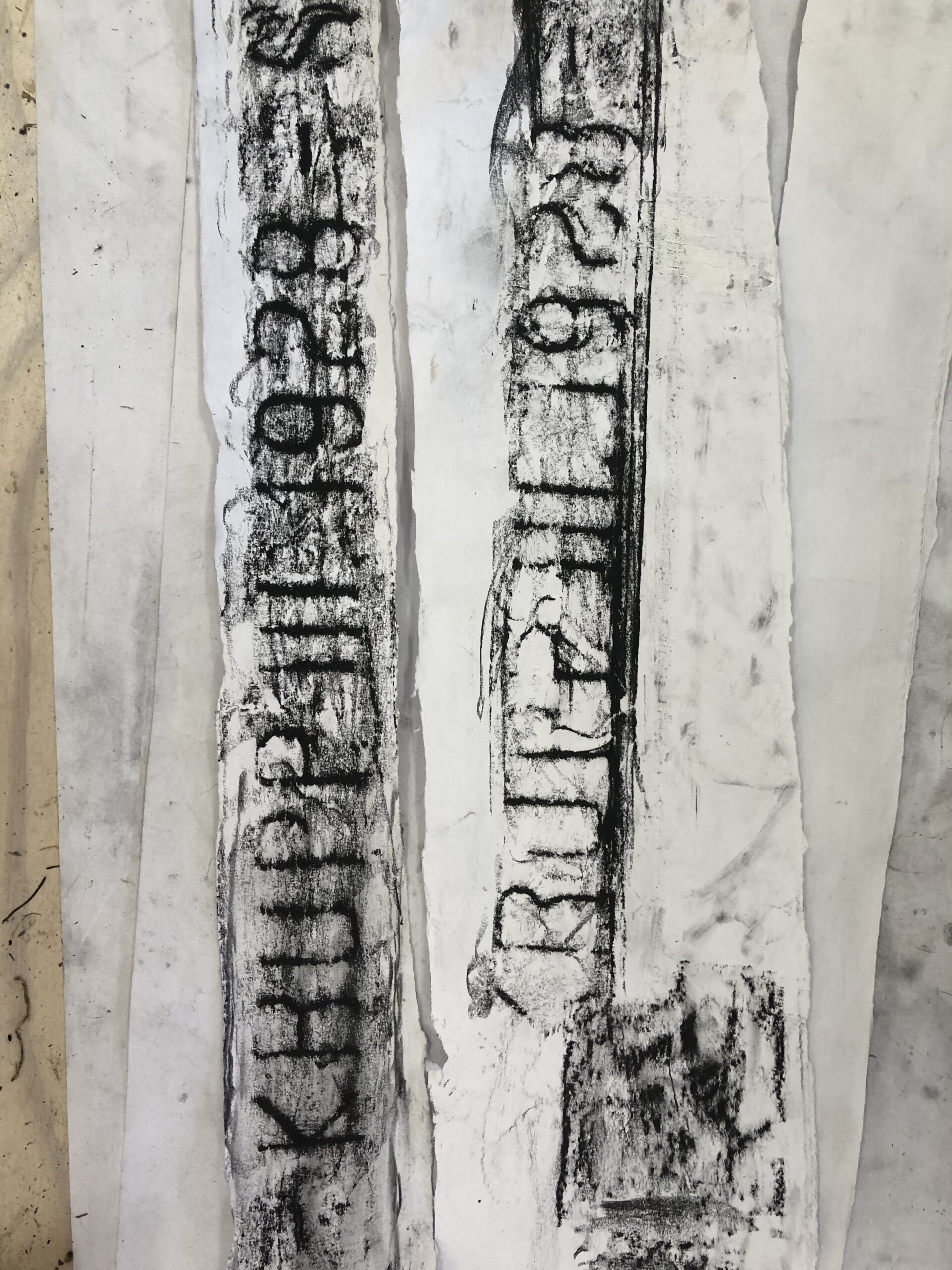
On the day I did a few other test works, I had a not-so-successful moment – the air-drying clay imprints were very brittle and broke into fragments when I removed them after drying overnight. At first, I saw this as a technical failure, but now I see it as a poetic truth: the history of the R311 is too heavy to be captured in a single, solid piece. My work must be like Le Guin’s carrier bag—a collection of shards, skins, and ghosts. The breakage isn’t the end of the work; it is the beginning of the archive. It is also a strong metaphor for the ‘collapse’ of this rail transport endeavour. Steel is meant to be permanent. Clay is fragile. By capturing a steel “identity” (the logo) in a medium that shatters (the clay), I have physically demonstrated the decay of the industrial promise. The rail didn’t just stop; the system that supported it “brittled” and broke, much like these test imprints.
Diary thoughts on 31/03/2026: As I scout the rail, I am struck by the friction between the human desire for abstraction and the earth’s insistence on impact. We marked this land with symbols—the interlocking circles of the Krupp emblem, the SAR inscriptions, the lines on a map. These were our ‘symbols of intent.’ I am thinking of this walk as a metaphor; the work is not about “drawing” a railway; I am busy “harvesting” the impacts the railway has left on the world (and that the world is now leaving on the railway).
At the place I intend to end the work, the Riebeek West station, the symbols have failed. The lines on the paper have blurred. What remains is the direct physical impact: the way a wall crumbles under the weight of rain, the way a platform holds the heat of a human body seeking shelter, and the way the rail itself is being digested back into the soil. My ‘carrier bag’ of specimens—the broken clay, the rubber skins, the plaster bandages—is not a collection of signs. It is a collection of impacts. I am recording the moment the human ‘line’ was reclaimed by the earth’s ‘weight’.
What’s striking is how different this must have been from modern transport – I imagine the train at a rhythm of the farms, stops were informal or even request-based. This line was almost acting as a moving gathering point. I imagine sounds of steam, metal, animals, voices – it was less a schedule in the strict sense and more a daily pulse through the landscape. ( A beautiful story was shared with me recently about a test drive for a driver’s license – but let me make sure I can disclose more at a later stage….)I am also thinking of how mapping brings together the physical journey (walking), the internal record (memory), and the social context (place). Linking trains and movementI want to bridge the gap between the rusted steel and the modern town. One should imagine the lines of the valley being much more fluid before farming and then when a railway cut a permanent scar through the valley.
- Animal Corridors: The San followed the migration of Eland and Quagga. These animals carved deep “paths of least resistance” through the fynbos. Interestingly, early colonial roads—and eventually some railway sections—might have been built directly over these ancient animal tracks because the animals had already found the most efficient way through the terrain.
- The Seasonal “Drift”: The Khoekhoe pastoralists moved their fat-tailed sheep in a “drift” across the Swartland. Their mark wasn’t a permanent structure, but the temporary kraal (enclosed and protective circle for cattle and even humans)
- The “Slow” Movement: The train moved at a human pace compared to today’s cars on the R311. My scroll can reflect this by having detailed, dense drawings near the stations and sparse, airy lines for the long stretches of vineyard and wheat fields in between.
- The Terroir/Soil: The rail exists because of the soil (Wheat and Wine). I can work with local earth pigments or crushed shale from the Kasteelberg to ink my scroll, literally binding the drawing to the land it depicts.
- History of humans in the area: Locate the rock paintings or any other relics in the Kasteelberg Mountain and other parts of the valley. Use the scroll to mark the exact points where the tracks pass other human historical sites, such as the birth houses of Malan at Allesverloren farm Bovenplaats where Smuts was born, Sonkwas drift, where local potter sculpturer and Khoisan afstammeling, Andries Dirks was born, Kloovenburg where rugby hero, Pieter Stef Du Toit was born and his family still lives. This frames the railway as the “exit ramp” that took local farm boys to global prominence.
Visual Metaphors
- The Parallel Line: Draw the original track in one colour (e.g., a rusted sepia) and the modern road/walking path in another. Where they diverge, or cross, is where the “tension” of your story lives.
- The Gradient: Use the elevation profile from Google Earth as the “horizon line” of your scroll. The physical ups and downs of the valley can dictate the rhythm of your drawing.
- Ghost Textures: Use rubbings. If you find a section of remaining rail or a stone culvert, place your paper over it and lift the texture directly onto your scroll.
4. Further Research Sources
For “hard” dates and rare photos to fill the scroll’s narrative:
- Transnet Heritage Library: They hold the original blueprints and “closing” notices for branch lines.
- The Riebeek Valley Heritage Society: They have local anecdotes about the last trains that ran through the valley.
On the WALC site, I learned about a book of work by a walking artist, Stuart McAdam, Lines Lost, 2013-14. McAdam interrogated the historical, cultural and contemporary resonances through a series of documented walks on lines that we cut in Northern Scotland. His main concern was the impact that the cuts had on the development and decline of the many towns and villages that lay along the historic routes, routes that were often lifelines for outlying communities.To comment on this, in our village, the main form of transport is not public transport, but private vehicles. I know of 2 school buses that travel on this road, as well as a few taxi services. Most of the farm labourers walk to town, or rely on weekly/monthly (not sure) transport to go into town.
The Walk as a “Trace”I can refer to the railway as a physical scar in the landscape, but my walk along it will be a temporal trace. The walk also talks to the linear vs the erratic. A railway line is made to get from A to B, my walk introduces ‘human time’. I will stop and look, almost deviating from the straight lines of the track to make art. My data points would be made by my body: the pace I walk at, the sensory inputs, like smells and sounds. The scroll can mirror the linear, unfolding nature of a railway and the passage of time.t Due to the temporal nature of the piece, which is a lived experience, the work is not an object. Those invisible lines are drawn not only along the ground, but through minutes, hours, and days.
First encounter: On Friday, 3 April 2026, I will take a short walk from the old Riebeek West station to commemorate the start of this rail 97 years ago. I have shared this planned walk on social media and hope to have fellow walkers alongside. A follow-up blog will discuss the experience, hopefully filled with discussions, shared memories, and a real feel for what it would have been like on that opening day.
Stories om op te volg
Ouma Anneke du Toit en haar lisensie rit – sy het oor die treinspoor gery tydens haar toetsrit, maar nie gestop.
Railway constable – a railway blom pot